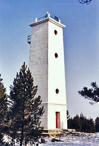
The lighthouse is located on the tip of Hiiesaare on the northeast coast of Hiiumaa. Helps to orient oneself in the northern part of the Väinamere and aims at 229.6° with the church tower of Paluküla (Est 626), helps to move from Püssirahu to Suursadama (Djuphamn; Tiefenhafen) raid.
On the tip of Hiiesaare (59° 00.13' N, 22° 51.42' E) a wooden day marker (Suuremõisa tank) was first erected in 1876. It formed a target SW 50° 15' with the church tower of Paluküla. A rectangular shield was attached to the top of the white trunk-pyramid-shaped wooden truss structure, the height of the top of which was 12 m above the ground, 13 m above sea level, and the visibility distance was 8 miles. The lower tank of Hiiesaari target SW 49° 45' was renewed in 1891 in a form similar to the previous one. Its height above the ground was 16 m and 17 m above sea level.
1910. A new four-sided stone red trunk pyramid was built in 2011, topped with a white square metal truss shield. The height of the tank above the ground was 16 m, 17 m above sea level. The day mark was destroyed in the Second World War.
1953. In 2010, a new 17 m high lighthouse was built on Hiiesaare in the shape of a four-sided trunk pyramid, the acetylene lantern at the top of which showed light in the sector 260°-130°, according to the standard project. The height of the fire above sea level was 18 m, the visibility distance was 10 miles, the nature of the fire: LFl W 7 s; 1.5 + 5.5 = 7 s. In the 1980s, the lighthouse was switched to a radioactive isotope generator and equipped with an EMS 210 (ЭMC 210) targeting lamp.
1994–2001. until 2010, the Hiiesaari lighthouse light did not burn, because the generator of radioactive isotopes was removed. After the repair, automatic solar-wind powered lighting devices were installed.
